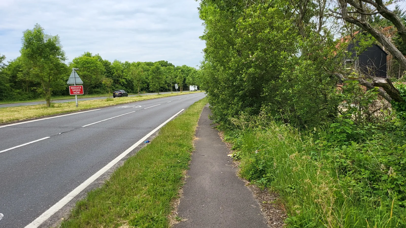

Up to 100,000 sq m of warehouses are planned beside M3 junction 5 at North Warnborough. Comments close on 4 December, and 96 people objected by 10 November.
A developer wants to build up to 100,000 square metres of warehouses and industrial units on farmland beside junction 5 of the M3, at North Warnborough. In its own worst case, the site would generate 7,040 vehicle trips a day, 2,412 of them by lorries.
The outline application, 26/01844/OUT, is open for comment on Hart District Council’s planning register until Friday 4 December. By 10 November the register showed 96 comments, all of them objections. (Hart District Council, planning register)
The applicant is Obsidian Strategic Asset Management, the same promoter behind the 80-home plan at Marsh Lane, Eversley. Its agent, Turley, submitted the scheme on 27 October and the council validated it on 30 October.
Where it is and what is planned
The site is 36.85 hectares of arable land farmed from Lodge Farm, on Hook Road. It sits about 180 metres north-east of North Warnborough, 0.6km from junction 5 and 1.3km south-east of Hook, according to the developer’s documents. It is in Odiham parish. (Covering letter, Turley, 27 October 2026)
The plans would bring:
- up to 100,000 sq m of floorspace for general industry (Use Class B2), storage and distribution (B8), or both
- buildings up to 24 metres high at their tallest
- between 804 and 1,926 car parking spaces and up to 112 lorry loading bays
- a new entrance off the A287 and B3349 roundabout, which would also serve Newlyns Farm Shop and the Lodge Farm Industrial Estate
- the demolition of a house at the site entrance
- a diverted public footpath through a landscaped corridor, and a 30-metre woodland belt on the south-eastern edge
It is an outline application. Only the access is fixed now; the layout, the buildings and their look would come later. The site is not allocated for development in Hart’s Local Plan or the Odiham and North Warnborough Neighbourhood Plan, so it counts as countryside in planning terms. The developer’s documents say the principle will be tested against the Local Plan’s policy on new employment. (Environmental Statement, non-technical summary)
The traffic
The developer tested the worst case for traffic: every building used for parcel distribution, which generates the most trips. In that case, its transport chapter forecasts in 2032:
- 7,040 vehicle trips a day through the new site entrance, two-way, on an annual average
- 2,412 of them by lorries
- on the A287 between junction 5 and Hook Road, lorry movements rising from 3,543 a day to 5,835, up 64.7%
- on the same stretch, all traffic rising by 16%, from 31,804 to 36,877 vehicles a day
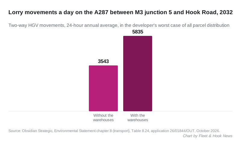
It expects most lorries to use the M3 and avoid built-up areas “where possible”. (Environmental Statement, chapter 8, transport)
The developer’s own assessment finds one significant harm on the roads: delay at junction 5. Changes there for walkers and cyclists would add delay on some approaches and cut it on others. In the morning peak, the wait for M3 westbound traffic going straight on rises from 16.4 seconds to 51.9 seconds. In the evening peak, the B3349 approach rises from 3.7 to 31.7 seconds. The M3 eastbound morning wait falls from 54.4 to 23.2 seconds. The chapter calls the overall effect “moderate adverse”, “significant and permanent”.
To offset the traffic, the plans offer:
- a widened roundabout, with a shared footpath and cycle path along the A287 to junction 5
- controlled crossings at the site entrance and at junction 5
- a proposed 50mph limit on the A287 between the site and junction 5
- possibly a bus diverted into the site, or a shuttle bus to Hook station
What else the developer’s assessment finds
The Environmental Statement lists other significant harms, after ten years of tree growth:
- the site itself changes from farmland to large buildings, lit at night: “major adverse”
- homes at Lodge Farm: “major adverse”; homes at Stonelea Grove and Derby Field: “moderate adverse”
- the Bartley and Loddon Valley landscape areas: “moderate adverse”
It says noise at most homes would be negligible once earth bunds and acoustic barriers are in place. It also notes a Roman villa, a protected ancient monument, and listed buildings at Lodge Farm. The developer says the current design moves buildings further from them than a February 2024 version, which had five buildings and up to 105,000 sq m.
On jobs, the developer forecasts between 940 and 2,440 full-time equivalent jobs, depending on who moves in. Building would take about 18 months. The assessment assumes a start in spring 2030 and completion in 2031, but says the real timetable “will depend on market demand”.
Why people are objecting
The first objections reached the register on 31 October. By 10 November there were 96, and none in support. The developer’s own consultation this year drew 277 responses, according to its Statement of Community Engagement.
The scheme also came up at Fleet Town Council on 4 November. The minutes record Hart councillor Alan Oliver saying it had passed validation and “could generate significant concern amongst local residents”. Councillor Steve Forster raised the combined effect of this and other proposed warehouse schemes on local roads and junctions. (Fleet Town Council, minutes, 4 November 2026)
The developer’s own landscape assessment names two other big schemes nearby whose effects could add up with this one: Land at Murrell Green, the 2,160-home plan we reported on in October, and Land Rear of Holt Farm.
What it means for you
- You can comment until Friday 4 December. Search for 26/01844/OUT on Hart’s planning register. Comments are public, so your name goes on the register.
- Comments count most when they are about planning matters: traffic, the countryside policy, landscape, heritage, noise and flooding. The documents include a non-technical summary written for residents.
- If you drive the A287 or use junction 5, the transport chapter sets out the forecast for your road. Highways responses from Hampshire County Council and National Highways are not on the register yet.
- The council’s target date for a decision is 19 February 2027. No committee date has been set.
More planning applications across the district are on our Fleet planning news page.
Sources
- Hart District Council, application 26/01844/OUT: the proposal, dates, applicant, agent, case officer and the comment count on 10 November.
- From the same application’s documents: the covering letter from Turley (27 October), the Environmental Statement non-technical summary, chapter 8 (transport, Tables 8.17 and 8.24), and the Statement of Community Engagement.
- Fleet Town Council, minutes, 4 November 2026.
Have your say